The Kitaura Coast: Whale Tomb, Volcanoes and Mishima Island
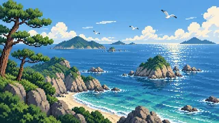
Torii line up facing the sea, and an island tomb holds unborn whales. The Kitaura coast of Yamaguchi comes into focus through volcanoes, whaling and island life.
Omijima in Nagato has cliffs and sea arches carved by rough seas along about 16 km, and is called the "Alps of the sea." In the village of Kayoi on the island, old-style net whaling was practiced in the Edo period, and people developed a culture of mourning the whales they caught by giving them posthumous names.
Going east along the coast, landforms made by the Abu Volcano Group appear at Kasayama in Hagi and on the Susa shore. Lava plateaus became farmland, and lava flows spreading under the sea became rich fishing grounds. Farther out float flat islands, and Mishima, where a group of tumuli said to be tombs of frontier guards remains.
On the tip of the peninsula at Mukatsugu stand the cape at the northwest end of Honshu and a temple where the Tang beauty Yang Guifei is said to have washed ashore. Elsewhere in Nagato, rice terraces look out over the Sea of Japan.
Omijima and the whalers of Kayoi: a seaside village that mourned whales
Omijima is a national place of scenic beauty and natural monument, and the whale tomb at Kayoi holds unborn whale calves. The village named its catches and mourned them in a song sung without clapping.
Omijima
Eroded by rough seas on its east, west and north sides, the island has sheer cliffs, sea arches, stone pillars and reefs stretching about 16 km. It is made mostly of tuff formed by volcanic activity around 90 million years ago, and sea cliffs and caves over 100 m high line the eastern and northern coasts. Designated a national place of scenic beauty and natural monument in 1926, it covers about 15 square kilometers and is the best-known island of Nagato. Although an island, it can be reached by car. The rocks in Higashiyama Kaii's 1968 mural "Morning Tide" in the Imperial Palace are said to be modeled on Omijima's.
Source:Omijima IslandOmijima Island
Net whaling
The sea off Kitaura lies on the route of whales that head south in winter to raise their young in warmer waters. At Kayoi, whalers drove them into nets and speared them, in the old style of net whaling. Records from 1672 show the "whale-spearing teams" of Senzaki bay taken on by the Choshu domain, and Nagato as a whole is said to have caught over 2,800 whales in about 200 years. Whaling in Kitaura declined as modern whaling arrived, and the last catch is said to have been in 1910. Whales stranded on the shore were shared among villagers as gifts from heaven. Even after whaling ended, eating whale stayed common; the local dish kujira no nanban-ni, which uses the skin too, is a relic of that.
Source:Yamaguchi Prefecture | Our Local DishesNagato Whale Museum
Omijima Whale Tomb
The whale tomb at Kayoi was built for the unborn calves found in catches; over 200 years to the Meiji era, more than seventy were buried here. It was erected in 1692 by the head of the whaling net crew. Made of granite, it is 2.4 m tall and 46 cm wide, with words of memorial for the whales carved on its face. Thirteen years earlier, in 1679, Sanyo Shonin, fifth head priest of Koganji temple in Kayoi, had built a Kannon hall at his retirement lodge and begun prayers for the whales caught. The tomb was designated a national historic site on December 24, 1935.
Source:Omijima Whale Tomb
Whale posthumous names and the Kayoi whale song
The whalers of Kayoi gave the whales they caught posthumous Buddhist names, just as for people. The names were written in a memorial book and on tablets kept at Koganji temple, and these are prefectural tangible folk cultural properties. Out of a sense of debt to the whales, the villagers held rites with gratitude and pity, and the memorial services are still held today. The Kayoi whale song, a municipal intangible folk cultural property, celebrates a big catch but is sung with rubbing hands instead of clapping, out of grief for the whale's death.
Senzaki and Misumi: where a poet, a painter and a reformer grew up
Senzaki is the birthplace of the poet Kaneko Misuzu, and Misumi that of the painter Kazuki Yasuo and the domain reformer Murata Seifu. Whaling culture at Kayoi is said to have shaped Misuzu's poems.
Kaneko Misuzu
Kaneko Misuzu was born in 1903 in Senzaki village (now part of Nagato). Her father, Shonosuke, was born in Kayoi on Omijima, and as a child she visited his family home. The whaling culture of Kayoi is said to have deeply influenced the gentleness and sadness of her poems, and one of her poems looks back on the time when whales stopped coming to Kayoi. She began writing children's verse in 1923 while minding a branch bookstore in Shimonoseki, and on submitting to magazines was praised by Saijo Yaso as a giant among young poets.
Source:Kaneko Misuzu Memorial Museum (Nagato City)Nagato Whale MuseumThe Resurrection of a Forgotten Poet: Kaneko Misuzu
Misuzu's 512 poems
It was the children's-literature writer Yazaki Setsuo who brought the long-buried poems back. In 1966, as a first-year university student, he read "Big Catch" in the Iwanami Bunko anthology of Japanese children's verse and felt as though his human-centered view had been turned upside down; he began looking for the poet. His only clues were that she had submitted poems from Shimonoseki, Yamaguchi, and that she had died young. In the sixteenth year after that first reading, around 1982, he tracked down her younger brother Uyama Masasuke in Tokyo, and 512 poems copied into three handwritten notebooks were found. They were published in 1984 as the complete works.
Source:The Resurrection of a Forgotten Poet: Kaneko MisuzuKaneko Misuzu | Portraits of Modern Japanese Historical Figures
Kazuki Yasuo
The painter Kazuki Yasuo was born in 1911 in Misumi village (now part of Nagato) and kept working there almost all his life; he loved the place, saying "This is my earth." Called up in 1943 and posted to Manchuria, he was held in Siberia after the war. The Siberia Series based on that experience consists of 57 oil paintings. The Kazuki Yasuo Museum opened in 1993 on a hill by the Misumi River in front of his birthplace, with works donated by his family, and it also holds his "toys," objects made from scrap.
Murata Seifu and Misumi
Misumi is also the home town of Murata Seifu. He led the Tenpo reforms and is said to have influenced Yoshida Shoin, the monk Gessho and Sufu Masanosuke, among others. In Misumi are the Murata Seifu Memorial Hall and an old-map walk, held by reservation from October 2026 to June 2027, that takes in his grave and the site of Sufu Masanosuke's house.
The tip of Nagato: Motonosumi Shrine, Kawajiri Cape, Nisonin and the Higashiushirobata rice terraces
Motonosumi Shrine was founded in 1955 after a white fox appeared at a fishing boss's bedside, and 123 torii line the coast. Kawajiri Cape is the far northwest tip of Honshu, and the same Mukatsugu peninsula holds Nisonin, tied to the Yang Guifei legend.
Motonosumi Shrine
It was founded in 1955, after a white fox appeared at the bedside of a local fishing boss with a message. Its blessings include good business, big catches, safe voyages, good matches, children and protection from ill fortune. Beginning in 1987, 123 torii were donated over ten years, and they stretch more than 100 m from the Ryugu blowhole. The shrine has no connection with Taikodani Inari Shrine in Tsuwano.
Source:Motonosumi Shrine
Kawajiri Cape
The cape lies at the northern edge of Nagato, at Yuya Mukatsugu-shimo, at 34 degrees 26 minutes north. It is known as the northwesternmost tip of Honshu, and its blue-green sea enchants visitors. Nagato itself borders Hagi to the east and Shimonoseki and Mine to the south, in the northwest of Yamaguchi Prefecture.
Source:Overview of Nagato City
Nisonin Temple
At Nisonin on the Mukatsugu peninsula in Yuya, a legend says that Yang Guifei, the beloved consort of Emperor Xuanzong of Tang, escaped execution during the An Lushan Rebellion, drifted to the peninsula's Towatari landing in a small boat and died soon after. Villagers are said to have buried her on the Kutsu hill, from which the western sea can be seen, and the five-ring stone tower in the temple grounds is said to be her tomb. The legend survives in an old document that the head priest wrote down in 1766 from what an elder told him; visitors grew in number as people said that prayers at the tomb come true.
Source:The Yang Guifei Legend
Higashiushirobata Terraced Rice Fields
The Higashiushirobata terraces in Nagato, where paddies spread in steps down a slope above the Sea of Japan, are among the "100 Best Terraced Rice Fields of Japan." Terraces are not only places to grow rice; they have recently been reassessed for protecting land through water control and for sustaining ecosystems. In May and June the fishing lights offshore and the paddies make a particularly fine scene, and photographers from inside and outside the city come for the shot.
Source:Higashiushirobata Terraced Rice Fields (100 Best Terraced Rice Fields of Japan)
The sea shaped by volcanoes: Kasayama, Susa, the Abu Volcano Group and Chomonkyo
About fifty small volcanoes, each erupting once, dot the Hagi area and are called the Abu Volcano Group. The newest is Kasayama, the fiercest was Iraoyama, and the Susa hornfels on the coast is another trace.
Kasayama
Hagi's Kasayama is the newest volcano in the Abu Volcano Group, and on the shore you can see andesite lava that erupted around 10,000 years ago. A scoria cone from the last phase of eruption survives with its crater intact, and the summit holds a crater about 30 m wide and 30 m deep that a path descends into. At its foot, Myojin Pond is a seawater pond left behind when the sandbar joined the former island to the land; it is connected to the open sea. Countless wind caves, large and small, breathe out cold air at about 15 degrees Celsius even in midsummer. At Toragasaki on the north tip, about 25,000 wild camellia trees grow over some 10 hectares, blooming from early December to late March.
Source:Kasayama, the Small Volcano: Nature and Local FlavorsHagi GeoparkOverview of Hagi City: Geography and Industry
Susa Hornfels
Hornfels is rock changed by heat when gabbro magma, the same that forms high mountains, intruded layers of sand and mud on the sea floor of the Sea of Japan and baked them. Its cross-section shows black-and-white stripes and the cliff is called "tatami rock." It is a remnant of igneous activity from the time the Sea of Japan opened, 20 to 15 million years ago. At Modoro Cape in Abu Town, in the same geopark, the cliffs at the tip are covered with a polka-dot pattern of white granite and black diorite, two magmas that mixed underground in the Cretaceous, when Japan was still part of the continent, and cooled that way.
The Abu Volcano Group and Iraoyama
Around Hagi are about fifty Quaternary monogenetic volcanoes, each erupting only once, together called the Abu Volcano Group. Iraoyama, which erupted about 400,000 years ago, is thought to have been the fiercest of them. Its lava flow, which ran about 14 km down a valley, is called the "path the dragon took," and hexagonal columnar joints can be seen in many places. Hagi Geopark covers all of Hagi and Abu plus the Ato area of Yamaguchi City, and lets visitors trace 100 million years of volcanic activity. The clay used for Hagi ware is also weathered granite from volcanic activity 100 million years ago.
Source:Hagi Geopark
The Hagi Six Islands
Off Hagi lie six flat volcanic islands: Oshima, Aishima, Hitsushima, Hashima, Hijima and Ojima. All are volcanoes of the Abu group, and their flat shapes come from lava that spread out and hardened into plateaus. Of the six, Oshima, Aishima and Hitsushima are inhabited. The sunny, well-drained lava plateaus of such monogenetic volcanoes became farmland, and lava flows under the sea became natural reefs and good fishing grounds. Mishima is not counted among the six and lies farther out to sea.
Source:Overview of Hagi City: Geography and IndustryKasayama, the Small Volcano: Nature and Local FlavorsHagi Geopark
Chomonkyo Gorge
Chomonkyo is a gorge formed when a lake dammed by a volcanic eruption burst its banks through river capture. At Teijigawa-deaibuchi, the site of the capture, two rivers can be seen meeting head-on. The gorge cuts through thick pyroclastic flow deposits left by a large Cretaceous eruption, and welded tuff and potholes can be seen in the riverbed at many points. It is a geosite of the Hagi Geopark, about five minutes on foot from JR Chomonkyo Station on the Yamaguchi Line.
Source:Hagi Geopark
Mishima: an island of cattle, burial mounds and thousand-year rice fields
Mishima is the northernmost island of Yamaguchi, in the Sea of Japan off Hagi, known for its national natural monument cattle, tumuli said to be tombs of frontier guards, and the thousand-year paddies of Hacchohattan.
Mishima cattle
These are native cattle kept on Mishima since long ago, and their habitat was designated a national natural monument on September 20, 1928. It is the only place in Japan where cattle are so designated. Smaller than Japanese Black cattle and slightly brownish-black, they take more than five years to mature, but are gentle, resistant to disease and able to live on poor feed, so they were kept for farm work. They have kept Japan's native bloodline free of foreign breeds.
Source:Mishima Cattle Habitat (Cultural Properties of Yamaguchi)Mishima Cattle Habitat
Hacchohattan
Mishima's Hacchohattan is a broad expanse of paddies said to have been farmed for more than a thousand years, called the "thousand-year field" for showing how early farming flourished here. The island was formed by eruptions around when the Sea of Japan was born. At Kannonzaki you can see a cross-section of the island formed by an eruption about 12 million years ago, and Hachirigase on the north side is a long-established fishing ground blessed with a lava plateau on the sea floor.
Source:Mishima Island
Mishima Jikonbo Tumuli
On the shore in the southeast of Mishima, close to 200 basalt stone mounds stand packed together in a cluster designated a national historic site. They are estimated to date from the late seventh to the early tenth century and are said to be the tombs of warriors stationed to guard against Silla incursions; they are also called the "tombs of frontier guards." One theory holds that "Jikonbo" means ancestors, since the local dialect calls grandparents "jiiko" and "baako."
Oniyozu kites and uni-meshi
On Mishima, a giant kite is made and flown in the New Year after a first son is born, and it is called an oniyozu. Relatives, acquaintances and friends gather to build it, wishing the child healthy growth, and it is regarded as a custom and craft unique to Mishima. Local dishes include uni-meshi, rice cooked with sea urchin and turban shell, and gube soup made with a shellfish locals call yome-no-sara. It is the food of an island rich in seafood thanks to the Tsushima Current.
Source:Mishima Island
A railway along the sea: the Sogogawa Bridge on the San'in Line
The Sogogawa Bridge on the San'in Line, between Susa and Udago, is a reinforced-concrete rigid-frame bridge across a river mouth at the water's edge, and it became Selected Civil Engineering Heritage in 2001.
Sogogawa Bridge
The bridge lies on the San'in Line between Susa and Udago, at Sogo in Abu Town, where it spans the mouth of the Sogo River right at the water's edge. It is a reinforced-concrete rigid-frame (rahmen) bridge about 189 m long and 11.6 m high. It was completed in August 1932, and when it opened in February 1933 the San'in Line was finally through from Kyoto to Habu. Wave erosion and salt damage were the design problems, and three plans were compared: a plate girder sprayed with mortar, a steel-reinforced concrete truss, and a reinforced-concrete rigid frame. The rigid frame won. Thick cover over the reinforcing bars answers the salt, and well-curb foundations guard against scouring at the river mouth. Splayed legs and a gentle curve that follows the shore mark its look, and it was selected as civil engineering heritage in 2001.
Source:Sogogawa Bridge Explanatory SheetSogogawa Bridge: Selected Civil Engineering Heritage 2001
FAQ
Can I drive to Omijima?
Yes. Although classed as an island, Omijima can be reached by car. To see its cliffs from the water, a sightseeing boat pier lies about a five-minute walk from JR Senzaki Station. The bay at Shizugaura has a campground and a beach, and the clear water makes the island a known diving spot.
What is buried in the whale tomb?
Unborn calves that were found inside the mothers. Over more than 200 years up to the Meiji era, over seventy were laid to rest here. The head of a whaling net crew built the tomb in 1692, and it survives as a national historic site marking how a whaling village mourned its catch.
Why is Kasayama called the "smallest active volcano in Asia"?
The city's tourism introduction says "toyo-ichi," rendered here as "in Asia." What can be pointed to in support is that Kasayama stands only about 112 m high and is the newest of the roughly fifty volcanoes of the Abu group. How "smallest in Asia" was worked out is not stated, so it is safest to read it as a slogan.
Where is Mishima?
It is an island in the Sea of Japan off Hagi, at the northernmost point of Yamaguchi Prefecture, with a circumference of about 18 km. It is not counted among the "Hagi Six Islands" that belong to the city. The Jikonbo tumuli, also called the tombs of frontier guards, mark it as an island that guarded the frontier, and a distinctive island culture lives on.
Sources & references
- Omijima Island
- Omijima Island
- Yamaguchi Prefecture | Our Local Dishes
- Nagato Whale Museum
- Omijima Whale Tomb
- Kaneko Misuzu Memorial Museum (Nagato City)
- The Resurrection of a Forgotten Poet: Kaneko Misuzu
- Kaneko Misuzu | Portraits of Modern Japanese Historical Figures
- Kazuki Yasuo Museum: The Painter Kazuki Yasuo
- Walking Misumi with an Old Map
- Motonosumi Shrine
- Overview of Nagato City
- The Yang Guifei Legend
- Higashiushirobata Terraced Rice Fields (100 Best Terraced Rice Fields of Japan)
- Kasayama, the Small Volcano: Nature and Local Flavors
- Hagi Geopark
- Overview of Hagi City: Geography and Industry
- Susa Hornfels Geo-Guide
- Mishima Cattle Habitat (Cultural Properties of Yamaguchi)
- Mishima Cattle Habitat
- Mishima Island
- Mishima Jikonbo Tumuli (tourist spot)
- Mishima Island
- Sogogawa Bridge Explanatory Sheet
- Sogogawa Bridge: Selected Civil Engineering Heritage 2001