The Strait That Turns Four Times a Day: Kanmon and Its Coast
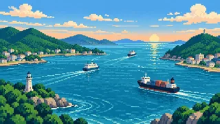
In Shimonoseki you can walk beneath the sea and step across a prefectural border. Moji, on the opposite shore, is five minutes away by boat. And the water in the strait itself changes direction four times a day.
The Kanmon Strait is a narrow channel joining the Suo-nada Sea to the east and the Hibiki-nada Sea to the west. People, cars, trains and the sea itself all move through it, most tightly at Hayatomo Strait. Locals often shorten its name to “Kanmon”.
From the four routes that cross the strait to the duel island of Ganryujima, from Tsunoshima and the westernmost tip of Honshu on the Sea of Japan side to the sea route to Busan, each of these places comes back to how tide and terrain have shaped daily life here.
A tide that turns four times a day: how Hayatomo Strait works
The current in the Kanmon Strait reverses about every six hours, four times a day. It runs west on the rising tide and east on the falling tide.
Hayatomo Strait
There are two high tides and two low tides a day, so the current flips twice for each, four times in all. It flows west on the rising tide and east on the falling tide. The tidal range is about 3.8 meters in the Suo-nada Sea to the east but only about 1.5 meters in the Hibiki-nada Sea to the west, and all that water squeezes through a narrow strait, which speeds it up. It ranks third in Japan after the Naruto and Kurushima straits, and the three are commonly called Japan’s Three Great Rapid Currents.
Source:About the Kanmon StraitKanmon Strait (encyclopedia entry)
Tidal current signal station
Markers below Hinoyama and other sites use lighted characters to tell ships the direction and speed of the current and whether it is strengthening or weakening. Ships use it as a guide for passage, and the Japan Coast Guard’s Kanmon Strait traffic center publishes the same kind of information online. In spring, thick fog can cut visibility and limit passage.
Source:Aids to navigation: tidal current signal stationsKanmon Strait current informationAbout the Kanmon Strait
Yojibegase
This hidden reef in Oseto surfaced at low tide and was feared as the “reef of death”; Toyotomi Hideyoshi’s ship is said to have run aground on it in July 1592. The ship’s captain, Akashi Yojibei, took responsibility and killed himself, and Hosokawa Tadaoki later raised a memorial on the reef, which is how it came to be called Yojibegase. The reef was blown up with explosives between 1912 and 1917 (Taisho 1 to 6).
Source:Hideyoshi’s shipwreck and the Yojibei stone (Kanmon history)Yojibegase (encyclopedia entry)Before the channel was improved (Kanmon history)
Four ways across: rail, road, bridge, bullet train, and a walkway on foot
In order of opening: the rail tunnel (1942), road tunnel (1958), Kanmon Bridge (1973) and Shinkansen tunnel (1975). Only the road tunnel’s walkway can be crossed on foot.
The four crossings
The rail tunnel opened in 1942, the road tunnel in 1958, Kanmon Bridge in 1973, and the Shinkansen’s new Kanmon Tunnel in 1975. The conventional-line (Sanyo Main Line) tunnel opened its down track in 1942 and its up track in 1944, so a “1944” you may see in some places is the up-track year. Alone among the four, that rail tunnel is said to run beneath Oseto, between Hikoshima and Kyushu, rather than Hayatomo Strait.
Source:Kanmon Strait (encyclopedia entry)JSCE selected civil engineering heritage: Kanmon Railway Tunnel
Kanmon Tunnel walkway
The Kanmon road tunnel has two levels, with vehicles above and a pedestrian walkway below, and it is free for walkers. The road tunnel as a whole is 3,461 meters long including its approaches, of which about 780 meters lies under the seabed. The walkway is about 780 meters long and takes roughly 15 minutes. An elevator takes you down about 55 meters on the Shimonoseki side and about 60 meters on the Moji side. Midway, the Yamaguchi-Fukuoka prefectural line lets you step from one to the other. The Kanmon Plaza on the Shimonoseki side displays construction photos and models.
Source:Kanmon Tunnel pedestrian walkwayKanmon Kaikyo Navi: accessKanmon National Route Tunnel
Kanmon Bridge
The bridge is 1,068 meters long with a 712-meter central span, stands 61 meters above the sea so large ships pass beneath, and carries motor vehicles only. Its grayish green paint is said to have been approved on condition of adding aviation obstruction lights, since Japan’s aviation law then required structures over 60 meters to be red or red and white, and the case is said to have prompted a revision of the rule.
Source:Civil engineering heritage in Kyushu: Kanmon Bridge関門橋(高速道路)(下関観光ガイドブック)Kanmon BridgeKanmon Kaikyo Navi: access
Kanmon ferry
Operated by Kanmon Kisen since 1989, the ferry is a daily link for residents of Shimonoseki and Moji Ward. On the Shimonoseki side it leaves from Karato Pier, beside Karato Market and Kamon Wharf, and lands at Moji Port Pier at Marine Gate Moji. Extra sailings run when events such as the Kaikyo Festival and the fireworks display draw crowds to both shores. On fireworks day the Nishitetsu highway bus between Fukuoka and Shimonoseki, nicknamed “Fukufuku-go,” also appears on the temporary bus-stop guide at Shimonoseki Station, and with no parking near the venues, public transport is the way to go.
Source:Kanmon Kaikyo Navi: accessKanmon ferry information関門海峡花火大会 下関・門司完全ガイド
Ganryujima and the islands of the strait
Ganryujima grew to several times its size at the time of the duel through cutting and reclamation, and Hikoshima drew closer to Honshu. Manju and Kanju are legendary islets.
Ganryujima
The island is where Miyamoto Musashi and Sasaki Kojiro are said to have fought in 1612. It was once called Funashima. Cutting that began in 1901 and land reclamation have enlarged it to several times its size at the time of the duel, and its shoreline is now about 1.6 kilometers. In 1886 a cholera hospital stood here. Boats from Karato Pier take about ten minutes.
Source:Ganryujima Island
The Kokura inscription
A monument to Musashi raised in 1654, the Kokura Hibun, names his opponent only as “Ganryu”; the name Kojiro does not appear. Musashi’s own Book of Five Rings does not describe the duel either, and the Yamaguchi Tourism Federation says nobody truly knows how much is fact. The famous scene was shaped by later retelling.
Source:Ganryujima Island
Manju and Kanju
Legend says Empress Jingu returned the tide-controlling jewels she had received from the deity Sumiyoshi to the sea, and they became two islands. The prefecture’s cultural-property entry says the names appear as far back as the Nihon Shoki. The islets are a detached part of Iminomiya Shrine’s grounds, and their forest was designated a national natural monument in 1926.
Source:Yamaguchi Cultural Properties: Manju and KanjuIminomiya Shrine: precinct guide
Hikoshima
A narrow channel called Koseto once separated Hikoshima from Honshu, and in 1942 its eastern end was reclaimed to make the entrance of Shimonoseki fishing port. Hikoshima is now linked by three bridges. The waterway that still divides it from the mainland has the Shimonoseki Fishing Port Lock, built on the same principle as the Panama Canal and said to be the smallest in the world.
Source:Kanmon Strait (encyclopedia entry)Bridges of HikoshimaThe world’s smallest Panama-style canal
Views over the Hibiki-nada Sea: Tsunoshima Ohashi, lighthouses, and Honshu’s western tip
On the Sea of Japan side are the toll-free Tsunoshima Ohashi Bridge, nationally designated lighthouses, and Bishanohana, the westernmost point of Honshu.
Tsunoshima Ohashi Bridge
This 1,780-meter bridge, completed in November 2000, is the longest in Yamaguchi Prefecture. When it opened it was the longest bridge to an island on an ordinary road in Japan. Before it, the town ferry ran seven times a day but often stopped in winter storms, disrupting medical care, schooling and firefighting, so islanders longed for a “bridge of dreams”. The project cost about 13.2 billion yen.
Source:Yamaguchi Prefecture materials on Tsunoshima Ohashi BridgeTsunoshima Ohashi Bridge (infrastructure tourism)Tsunoshima Ohashi Bridge (Shimonoseki guidebook)
Mutsurejima and Tsunoshima lighthouses
Mutsurejima Lighthouse, first lit in 1871, is a stone tower about ten meters high, said to be one of those built as ports opened at Hyogo. It was designated an Important Cultural Property on 23 December 2020, together with Tsunoshima Lighthouse.
Bishanohana
The headland is presented by Shimonoseki City as the westernmost point of Honshu. Its viewing plaza faces the Sea of Japan about 120 meters above sea level and is said to offer the latest sunset on Honshu. It is about 25 minutes by car from JR Yoshimi Station. Dannoura and Hinoyama on the strait are near the western end of Honshu but are not the tip itself.
Source:Honshu’s four extremities: Bishanohana, the western endShimonoseki guidebook: northern area
Yamanokami rites of Futaoijima
Counted the old way, the rite comes every seventh year, which is really an interval of six. It lasts four days around the 15th of the eleventh lunar month, in four sacred groves on the island, and four families and a priest present offerings including rice cakes shaped like the moon and the sun. Records go back to 1796, and it is a nationally selected intangible folk cultural property.
Source:Yamaguchi Cultural Properties: Yamanokami rites of FutaoijimaCultural Heritage Online: Yamanokami rites of Futaoijima
Ports that reach overseas: the Busan ferry, Hinoyama, and Kaikyokan
Shimonoseki has been linked to Busan by sea since the Kanpu ferry of 1905, and in 1970 Japan’s first international scheduled ferry line opened here.
Kanpu Ferry
Its predecessor, the Kanpu liaison ship, opened on 11 September 1905 under the private company Sanyo Steamship, and later became state-run. It ran almost daily for about forty years until 1945 and served as a route to Manchuria and Europe via Busan, though an article by a city international-affairs staff member in the magazine Chosen Tsushinshi also says that many Koreans were taken to Japan by that route. The Kanpu Ferry that opened in 1970 links the main pier area of Shimonoseki Port with Busan every day.
Source:The significance of the Kanpu ferry’s 100th anniversary (Chosen Tsushinshi, February 2006)Outline of city administration (chronology)Kanpu Ferry
Hinoyama
The 268.2-meter summit has a park with a full view of the strait and Kanmon Bridge. A signal-fire beacon once stood near the summit, which is said to be where the name Hinoyama, or “fire mountain”, comes from. The park lies within Setonaikai National Park, and its view is certified as a Japan Night View Heritage site. An observation deck called Hinoyama Ring opened at the summit in April 2026 (this page reflects information as of October 2026). Redevelopment is ongoing, so some facilities may be restricted.
Source:Basic redevelopment concept for the Hinoyama area (summary)Hinoyama Park (Shimonoseki guidebook)Hinoyama Park
Kaikyokan
The city aquarium’s Kanmon Strait Tidal Tank recreates the strait’s violent currents, and its Penguin Village is one of the largest penguin exhibits in Japan. The August 2025 renovation added Hireashi Beach, a facility for displaying and breeding sea lions. You can meet the speed of the tide in a tank before looking at the real strait.
Source:Kaikyokan Aquarium
FAQ
Until what time can you walk the Kanmon Tunnel, and what about bicycles?
It is open from 6:00 to 22:00. Bicycles and small motorbikes must be pushed rather than ridden, and a fee of 20 yen is listed (fees can change).
How fast is the current in the Kanmon Strait?
Most explanations give a maximum of around ten knots, roughly 18 kilometers an hour, while one encyclopedia says eight. Numbers shift with place, season and method of measurement, so take the ranking, officially third in Japan, as a rough guide too.
How do you get to Ganryujima?
By boat from Karato Pier in about ten minutes. Sailing days and times can change, so check the operator’s notice before you go.
Is Tsunoshima Ohashi the longest bridge in Japan?
Not quite. Shimonoseki’s guidebook calls it one of the longest toll-free bridges to an island in Japan. The bridge is managed by Yamaguchi Prefecture’s Shimonoseki civil engineering office.
Sources & references
- About the Kanmon Strait
- Kanmon Strait (encyclopedia entry)
- Aids to navigation: tidal current signal stations
- Kanmon Strait current information
- Hideyoshi’s shipwreck and the Yojibei stone (Kanmon history)
- Yojibegase (encyclopedia entry)
- Before the channel was improved (Kanmon history)
- JSCE selected civil engineering heritage: Kanmon Railway Tunnel
- Kanmon Tunnel pedestrian walkway
- Kanmon Kaikyo Navi: access
- Kanmon National Route Tunnel
- Civil engineering heritage in Kyushu: Kanmon Bridge
- 関門橋(高速道路)(下関観光ガイドブック)
- Kanmon Bridge
- Kanmon ferry information
- 関門海峡花火大会 下関・門司完全ガイド
- Ganryujima Island
- Yamaguchi Cultural Properties: Manju and Kanju
- Iminomiya Shrine: precinct guide
- Bridges of Hikoshima
- The world’s smallest Panama-style canal
- Yamaguchi Prefecture materials on Tsunoshima Ohashi Bridge
- Tsunoshima Ohashi Bridge (infrastructure tourism)
- Tsunoshima Ohashi Bridge (Shimonoseki guidebook)
- Mutsurejima Lighthouse
- Tsunoshima Lighthouse
- Honshu’s four extremities: Bishanohana, the western end
- Shimonoseki guidebook: northern area
- Yamaguchi Cultural Properties: Yamanokami rites of Futaoijima
- Cultural Heritage Online: Yamanokami rites of Futaoijima
- The significance of the Kanpu ferry’s 100th anniversary (Chosen Tsushinshi, February 2006)
- Outline of city administration (chronology)
- Kanpu Ferry
- Basic redevelopment concept for the Hinoyama area (summary)
- Hinoyama Park (Shimonoseki guidebook)
- Hinoyama Park
- Kaikyokan Aquarium