Living With Sakurajima: the 1914 Eruption and the Kokuhai Ash Bag
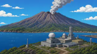
Sakurajima rises just a few kilometers from downtown Kagoshima, and the Japan Meteorological Agency still watches it around the clock. Here is what the 1914 eruption actually did, and how the city built daily life around living beside an active volcano, with sources throughout.
Sakurajima sits only a short distance from the city center, yet it has erupted again and again throughout recorded history. Four major Plinian eruptions are documented in the historical record, and the most recent of them, the Taisho eruption of 1914, reshaped the very geography of the volcano.
This article covers what actually happened during the Taisho eruption, how the current alert-level monitoring system works, and the kokuhai bag, a distinctly Kagoshima City system for coping with volcanic ash in everyday life.
Sakurajima is still an active, erupting volcano
It is one of the volcanoes Japan monitors around the clock, and the 1914 Taisho eruption even reshaped the coastline.
A round-the-clock monitored volcano
Japan has 111 active volcanoes for which the Japan Meteorological Agency issues eruption forecasts and warnings, and of those, the 50 judged to need the closest disaster-prevention attention are designated for round-the-clock monitoring by the agency and university researchers. Sakurajima is one of them. Its status is published continuously as an eruption warning level, on a five-step scale running from level 1, meaning simply be aware this is an active volcano, up to level 5, meaning evacuate.
The Taisho eruption
The Taisho eruption, which began on January 12, 1914, produced more erupted material than any other volcanic event in twentieth-century Japan. Counting victims of the magnitude-7-class Sakurajima earthquake that struck during the eruption, the official death and missing toll stands at 58, though records of imperial relief payments suggest the true number may have been higher. Lava pouring from vents on the east and west flanks filled the roughly 360-meter-wide Seto Strait, and by the end of January, Sakurajima was physically connected to the Osumi Peninsula.
Source:Wikipedia, the Taisho Great Eruption of Sakurajima (桜島の大正大噴火)
Coping with ash, and a lesson learned the hard way
Kagoshima City hands out free kokuhai bags for ash cleanup, and the 1914 disaster's lesson is still carved into a monument today.
The kokuhai bag
This is a bag designed for collecting volcanic ash that settles on private property, distributed free of charge by Kagoshima City at its main office, branch offices, and community welfare halls. When distribution began in fiscal 1985, the bags were called kohai bukuro, or fall-ash bags; the name changed to kokuhai bukuro, meaning ash-conquering bag, in 1991. Residents place collected ash at a designated roadside pickup point, and the city clears it away by two-ton truck.
The Sakurajima Eruption Memorial
Before the Taisho eruption, the village of Higashi-Sakurajima repeatedly asked the local weather station whether an eruption was likely and was told there was no danger, a delay that cost 25 lives, including the village mayor and treasurer. The village clerk who survived that day later became mayor himself, and in 1923 proposed a memorial to the village council. The stone that resulted, carved with words urging residents never to trust theory alone and to prepare to evacuate the moment they sense something is wrong, still stands in the schoolyard of what is now Kagoshima City's Higashi-Sakurajima Elementary School.
Source:Wikipedia, the Taisho Great Eruption of Sakurajima (桜島の大正大噴火)
Kurokami Buried Torii
The roughly three-meter-tall torii gate of Haragosha Shrine in the Kurokami district was buried under pumice and ash within a single day of the Taisho eruption; today only about one meter of its crossbeam still shows above ground. The village mayor at the time chose to leave the gate buried rather than dig it out, so the memory of the eruption would be passed on to later generations. It was designated a Kagoshima Prefecture natural monument in 1958. For a view of the crater itself today, Yunohira Observatory, at 373 meters on Kitadake, is the closest publicly accessible viewpoint on the mountain.
Source:Kagoshima City official tourism, Kurokami Buried Torii (黒神埋没鳥居)Kagoshima Prefecture official tourism, Kurokami Buried Torii (黒神埋没鳥居)
FAQ
Is Sakurajima still erupting today?
Its largest documented eruption remains the 1914 Taisho eruption, but activity centered on the summit craters, Minamidake and the Showa crater, has continued since, and the Japan Meteorological Agency keeps it under round-the-clock observation to this day.
Why is it still called an island if it is connected to land?
Geographers call this kind of landform a land-tied island. Even after the 1914 eruption physically joined it to the Osumi Peninsula, both the volcano itself and the surrounding district have kept the name Sakurajima.
What if a household runs out of kokuhai bags?
According to Kagoshima City guidance, residents without a kokuhai bag on hand can use two ordinary plastic shopping bags layered together instead, as long as they hold up without tearing. Either way, the bag needs to be tied shut before it goes out to the collection point.
Can the never trust theory alone monument still be visited?
Yes. It still stands in the schoolyard of Kagoshima City's Higashi-Sakurajima Elementary School, carrying the lesson that when residents sense the signs of danger, they should act on their own judgment rather than wait for an official verdict.