Yamaguchi's Place Names: Provinces, Mints, Polders and Barriers
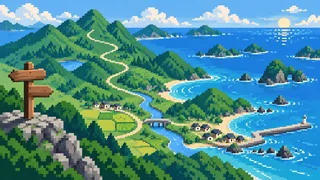
Follow Yamaguchi's place names across a map and four layers appear, stacked on top of each other: the names of two old provinces, ancient government offices, reclaimed rice land, and ports and barrier stations. Islands whose names have disputed origins, and names written with Japan-made characters, are scattered across them.
Suo Province covered the eastern half of today's prefecture and Nagato the western half; together they are called Bocho. The province names are still in use, and so are the names of the places where the provincial offices stood and of the shallow seabed that Edo-period engineers turned into fields. They survive as district and town names, unchanged.
The names chosen are ones whose origins and history can be checked against a source. Where an origin is disputed and no single explanation is settled, the text says that several explanations exist and does not present any one as fact. The readings rest on Japan Post and other public records.
Two provincial names: Suo and Nagato
Suo is the eastern part of today's Yamaguchi and Nagato the western half. Nagato is thought to come from Anato, meaning the Kanmon Strait, while the meaning of Suo is unknown.
Nagato (長門)
It was once written 穴門 or 穴戸 and read Anato. Ana (穴) means a hollow and to (門) a narrow strait or gate, and the name is thought to refer to the Kanmon Strait, giving the province its name. The characters 長門 first appear in a source in 665, and the provincial capital stood in what is now Chofu in Shimonoseki.
Source:Nagato Province (Historical Place-Name Dictionary / World Encyclopedia / Yamakawa)
Suo (周防)
It was originally written 周芳, and the form 周防 first appears in a record of 697. Whether it was read Suha or Suhau is undecided, and the meaning of the name is unclear. The seat of the Suo no kuni no miyatsuko clan, from whom the province is thought to take its name, is placed around Kozuo in Hikari.
Source:Suo Province (Historical Place-Name Dictionary / World Encyclopedia / Nipponica)Japan Post postal code search: Hikari, Yamaguchi
Abu (阿武)
Before the legal codes took shape, an Abu region is thought to have stood apart from Anato. Its center lay in today's Abu District, and it was later absorbed into Nagato Province. The province is gone, but the name survives in Abu District and Abu Town.
Source:Nagato Province (Historical Place-Name Dictionary / World Encyclopedia / Yamakawa)Japan Post postal code search: Abu, Yamaguchi
Bocho (防長)
A collective name for the two provinces; dictionaries define it as today's Yamaguchi Prefecture. After the Battle of Sekigahara in 1600 the Mori family was cut down to Suo and Nagato and moved its seat from Hiroshima to Hagi.
Source:Bocho (Digital Daijisen / Nihon Kokugo Daijiten)Suo Province (Historical Place-Name Dictionary / World Encyclopedia / Nipponica)
Offices that became place names: Kokuga, Sabaryo and the Yamaguchi mint
Kokuga and Higashi-Sabaryo in Hofu mark where Suo Province's offices stood, and the 鋳銭司 district in Yamaguchi City is named for a mint. Ancient offices became district names.
Kokuga (国衙)
This is where the Suo provincial capital stood, and the district name today is still Kokuga. Excavation and the surviving street grid confirm that the capital measured eight cho on a side. Names tied to government offices, such as 国庁, 朱雀, 船所 and 細工所, are said to survive across the old capital area.
Source:Suo Province (Historical Place-Name Dictionary / World Encyclopedia / Nipponica)Japan Post postal code search: Hofu, Yamaguchi
Sabaryo (佐波令)
Sabaryo, which gives Higashi-Sabaryo its name, lies south of the Saba River. The Suo provincial offices and provincial temple stood there, and the San'yo road ran east to west through it, making it an important point on Inland Sea traffic. In Hofu the character 令 is read ryo.
Source:Sabaryo (Historical Place-Name Dictionary of Japan)Japan Post postal code search: Hofu, Yamaguchi
鋳銭司 (Yamaguchi City)
The name of the ancient office that cast coins. It originally stood in Chofu, in Nagato Province, and in 825 was moved to Suo, to the 鋳銭司 area of Yamaguchi City. In the early modern period the area, together with its western hamlet Sue (陶), was called the village of 鋳銭司, and it is the birthplace of Omura Masujiro.
Source:Juzenshi mint office (World Encyclopedia / Nipponica)Suo Province (Historical Place-Name Dictionary / World Encyclopedia / Nipponica)
Naganobori (長登)
Nagato was one of the main copper-producing provinces in the Nara period, with ore coming from mines including Naganobori. The copper source and the office that minted coins were in the same province. The mint moved to Suo in 825, after which Nagato returned to ordinary rule by its governor.
Source:Nagato Province (Historical Place-Name Dictionary / World Encyclopedia / Yamakawa)Japan Post postal code search: Mine, Yamaguchi
Memories of reclaimed land: kaisaku and salt fields
Kaisaku means reclaimed land. The Edo-period Hagi domain pursued it eagerly to add rice fields, and the name survives in Ube's Nakano-gaisaku and Shunan's Urayama-kaisaku. Some names are voiced and some are not.
Kaisaku (開作)
It means land reclamation. Reclamation from the sea in western Japan is named differently by former domain, and on the Inland Sea the words kaisaku and shinkai are used. Some Yamaguchi town areas, such as Nakano-gaisaku in Ube and Urayama-kaisaku in Shunan, carry kaisaku in the name. The Edo-period Hagi domain pursued kaisaku actively to raise income, and it came in several kinds, including public-works, granted, temple-and-shrine and self-funded reclamation.
Source:Kaisaku (Hofu City history glossary / World Encyclopedia)Japan Post postal code search: Ube, Yamaguchi
Nakano-gaisaku (中野開作)
Here kaisaku is voiced to gaisaku instead of kaisaku, an instance of rendaku, in which a following word starts with a voiced sound. Voicing is not the rule for kaisaku names, though: the reading of each reclaimed-land name is registered town area by town area, and anyone who remembers "kaisaku voices" will be caught out by some of them.
Source:Japan Post postal code search: Ube, YamaguchiRendaku (Digital Daijisen / World Encyclopedia)
Urayama-kaisaku (浦山開作)
Shunan's Urayama-kaisaku keeps kaisaku unvoiced. The same city also has an Urayama district, read Urayama. Anyone who learned voiced names such as Ube's Nakano-gaisaku first will voice this one by mistake. The land is the same kind of reclaimed ground, but whether the word voices has to be checked name by name.
Mitajiri (三田尻)
Alongside reclamation, the coast was also remade into salt fields. Mitajiri-Furuhama was built in 1699 and Hirao-hama in 1704, and salt pans opened one after another in early modern Suo, which became the country's second salt producer after Harima. Mitajiri was also known as a port on the Inland Sea route.
Source:Suo Province (Historical Place-Name Dictionary / World Encyclopedia / Nipponica)Akamagaseki (Historical Place-Name Dictionary / Yamakawa / World Encyclopedia)
Ports and barriers: Akamagaseki, Kaminoseki, Murozumi and the northern coast
Akamagaseki is the old name of Shimonoseki, called the lower barrier to Kaminoseki's upper one. Ports on the Inland Sea route and the whaling coast of the north left their names in districts and stations.
Akamagaseki (赤間関)
An old name for Shimonoseki, also written 赤馬関 or 馬関. Explanations of the name include the red-eyed dragon theory, a theory from the boat nickname "red horse," and the akima theory. It was also called Shimonoseki, the lower barrier, in contrast to the Kamadoseki (Kaminoseki) barrier in today's Kaminoseki Town.
Source:Akamagaseki (Historical Place-Name Dictionary / Yamakawa / World Encyclopedia)Japan Post postal code search: Shimonoseki, Yamaguchi
Kaminoseki (上関)
The barrier at Kamadoseki in Kaminoseki was called the upper barrier, and Akamagaseki was the lower barrier by contrast. Both barrier names survive as the names of Kaminoseki Town and Shimonoseki City. Murotsu and Iwaishima are also places in Kaminoseki Town.
Source:Akamagaseki (Historical Place-Name Dictionary / Yamakawa / World Encyclopedia)Japan Post postal code search: Kaminoseki, Yamaguchi
Murozumi (室積)
The Mori family, which ruled the two provinces in the early modern period, reclaimed shallow Inland Sea waters while the growth of the sea route opened up port towns such as Akamagaseki, Mitajiri, Murozumi, Kaminoseki and Yanai. Zobigasaki, the spit that runs north from the eastern end of the Murozumi peninsula, lies within that port town.
Source:Akamagaseki (Historical Place-Name Dictionary / Yamakawa / World Encyclopedia)Zobigasaki and Mt. Gabi (Murozumi Kuso Keikakusha)
Kayoi, Kiwado and Kawashiri (通・黄波戸・川尻)
On the Sea of Japan side, the northern coast had thriving whaling in the Edo period, and from 1672 the Choshu domain protected and encouraged whaling groups. They competed from Kayoi and Kiwado in Nagato City and from Tateishi and Kawashiri in Yuya. Kawashiri Cape lies at the northern tip of the Mukatsuku Peninsula and is described as the northwesternmost point of Honshu, and Kiwado is also a JR station name.
Source:Nagato Province (Historical Place-Name Dictionary / World Encyclopedia / Yamakawa)Kawashiri Cape (Nagato City)Kiwado station information (JR-Odekake.net)
Kanmon (関門)
The name combines the kan of Bakan and the mon of Moji, and the strait is said to have formed about 6,000 years ago when Honshu and Kyushu separated. The old name of Nagato Province, Anato, is also said to refer to this strait.
Source:Kanmon Strait (Oidemase Yamaguchi)Nagato Province (Historical Place-Name Dictionary / World Encyclopedia / Yamakawa)
When origins are disputed: islands
Mutsurejima and Futaoijima each have several traditional origins. Neither is settled on one; the article only records that the explanations exist.
Mutsurejima (六連島)
Explanations of the name include small islets lined up around it, six settlers who divided the island into six equal shares, and a change from a Korean word for "settlement." No one explanation is settled, but the reading can be checked against public records.
Source:Mutsurejima island (Yamaguchi Prefecture island guide)Japan Post postal code search: Shimonoseki, Yamaguchi
Futaoijima (蓋井島)
Two traditional origins are told. In one, Empress Jingu stopped at the island, praised its water and then covered it with a lid (futa); in the other, a clear-water pond used for sacred water at a shrine ritual was firmly covered with a lid after each drawing. Both are about covering water with a lid, which matches the character 蓋.
Source:Futaoijima island (Yamaguchi Prefecture)Japan Post postal code search: Shimonoseki, Yamaguchi
Characters born in Japan: kokuji and Hagi
垰 and 糀 are kokuji, characters created in Japan, used in Shunan City place names. Even 萩 is given as an example of a character used in Japan with a wholly different meaning.
Tao (垰)
This district takes a kokuji for the hollow between two peaks as its name, read Tao. Kokuji are characters made in Japan and usually have only a native reading and no on-yomi. It is not read "toge."
Source:Japan Post postal code search: Shunan, YamaguchiKokuji (Digital Daijisen / Britannica)Kanji 垰: radical, strokes, readings and meaning (Kanji Jiten Online)
Koji-machi (糀町)
糀 is also a kokuji, read koji. The end of the Shunan district name is read machi rather than cho. Kokuji lean on native readings, so each has to be memorized on its own.
Source:Japan Post postal code search: Shunan, YamaguchiKokuji (Digital Daijisen / Britannica)Kanji 糀: radical, strokes, readings and meaning (Kanji Jiten Online)
Hagi (萩)
Britannica cites 萩 as a character whose shape exists in China but is used in Japan with a wholly different meaning, and some explanations count it as kokuji. For the city's name, the city's own page introduces two accounts: that tsubaki (camellia) was contracted to hagi, and that there was a hill thick with bush clover nearby. Both are reported accounts, not settled facts.
Source:Kokuji (Digital Daijisen / Britannica)Hagi City overview (emblem, flower, tree)
FAQ
What is kaisaku, and why are there so many in Yamaguchi?
It is a word for reclaimed land, and behind the many Yamaguchi names is the Hagi domain, which reclaimed land energetically as a policy to add fields. Town-area readings come in both gaisaku and kaisaku, so none can be assumed and each has to be checked.
How does the place name 鋳銭司 connect to the ancient office?
The name of the ancient office that cast coins survives, unchanged, as a district name in southern Yamaguchi City. The office moved from Nagato Province to Suo Province in 825, and that site is today's 鋳銭司. Reference works record the office's name as Jusenshi or Chusenshi, and the sources consulted do not explain the change in sound between the office name and the place name.
Which part of Yamaguchi does Bocho refer to?
The two provinces together. In 1871, the year the domains were abolished, the prefectures of Yamaguchi, Iwakuni, Toyoura and Kiyosue were created, and at the end of that year all were merged as Yamaguchi Prefecture. Bocho and today's prefecture nearly coincide.
What kind of characters are 垰 and 糀?
They are kokuji made in Japan, as are 峠, 畑, 辻 and 榊. Because kokuji usually have only native readings, 垰 is Tao and 糀 is koji, readings that cannot be worked out from the shape of the character and have to be learned one by one.
Sources & references
- Nagato Province (Historical Place-Name Dictionary / World Encyclopedia / Yamakawa)
- Suo Province (Historical Place-Name Dictionary / World Encyclopedia / Nipponica)
- Japan Post postal code search: Hikari, Yamaguchi
- Japan Post postal code search: Abu, Yamaguchi
- Bocho (Digital Daijisen / Nihon Kokugo Daijiten)
- Japan Post postal code search: Hofu, Yamaguchi
- Sabaryo (Historical Place-Name Dictionary of Japan)
- Juzenshi mint office (World Encyclopedia / Nipponica)
- Japan Post postal code search: Mine, Yamaguchi
- Kaisaku (Hofu City history glossary / World Encyclopedia)
- Japan Post postal code search: Ube, Yamaguchi
- Rendaku (Digital Daijisen / World Encyclopedia)
- Japan Post postal code search: Shunan, Yamaguchi
- Akamagaseki (Historical Place-Name Dictionary / Yamakawa / World Encyclopedia)
- Japan Post postal code search: Shimonoseki, Yamaguchi
- Japan Post postal code search: Kaminoseki, Yamaguchi
- Zobigasaki and Mt. Gabi (Murozumi Kuso Keikakusha)
- Kawashiri Cape (Nagato City)
- Kiwado station information (JR-Odekake.net)
- Kanmon Strait (Oidemase Yamaguchi)
- Mutsurejima island (Yamaguchi Prefecture island guide)
- Futaoijima island (Yamaguchi Prefecture)
- Kokuji (Digital Daijisen / Britannica)
- Kanji 垰: radical, strokes, readings and meaning (Kanji Jiten Online)
- Kanji 糀: radical, strokes, readings and meaning (Kanji Jiten Online)
- Hagi City overview (emblem, flower, tree)