Nagasaki City: Harbor and hillside streets
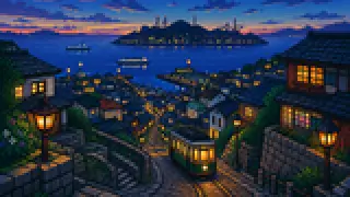
Nagasaki's downtown is built on a slope running down to the harbor, threaded by a tram line that has climbed it since 1915. This guide traces the names layered onto that slope back to the events that produced them.
In 1859, Nagasaki Harbor opened alongside Yokohama and Hakodate as one of the five ports designated under the Ansei treaties, and the city grew outward from that harbor. Minami-Yamate and Higashi-Yamate, the former foreign settlements; the tram that now runs through downtown; and Shianbashi, a place name that outlived the bridge it was named for, all carry traces of that era.
This article works through eight names — Nagasaki Harbor, Nagasaki Tram, Shianbashi, Minami-Yamate, Higashi-Yamate, Dutch Slope, Nagasaki Kaido, and City of Slopes — anchored to the dates and facts behind each one.
Harbor and hillside streets: Nagasaki Harbor and Nagasaki Tram
Nagasaki Harbor opened in 1859 alongside Yokohama and Hakodate, while the Nagasaki Tram began running more than half a century later, in 1915.
Nagasaki Harbor
Nagasaki Harbor opened in 1859, one of five ports the shogunate opened to foreign trade alongside Yokohama and Hakodate. It has served ever since as the link between the city, its outlying islands, and overseas shipping routes, and its Matsugae International Terminal today welcomes cruise ships.
Nagasaki Tram
The city's tram network opened in 1915, run by Nagasaki Electric Tramway and known for its flat, single fare regardless of distance. One car that survived the atomic bombing is still kept in working order and runs a special service every August 9. The tram arrived well over fifty years after the harbor itself opened.
Harbor and hillside streets: Shianbashi and Minami-Yamate
Shianbashi keeps the name of a bridge that no longer exists, tied to hesitation before crossing into the pleasure district, while Minami-Yamate is a foreign settlement built after Nagasaki Harbor opened in 1859.
Shianbashi
Shianbashi is said to take its name from visitors who paused to "consider" (shian) whether to cross the bridge into the Maruyama pleasure district. The bridge itself is gone, but the name survives as the label for a downtown entertainment district in central Nagasaki.
Minami-Yamate
Minami-Yamate was one of the foreign settlements developed after Nagasaki Harbor opened in 1859, occupying a hillside overlooking the water that also holds Glover Garden and Oura Church. Its Western-style buildings and stone-paved streets earned it designation as a Preservation District for Groups of Historic Buildings in 1991.
Harbor and hillside streets: Higashi-Yamate and Dutch Slope
Higashi-Yamate is a former foreign settlement alongside Minami-Yamate, while Dutch Slope is the name given to a stone-paved slope that runs through it.
Higashi-Yamate
Like Minami-Yamate, Higashi-Yamate is a former foreign settlement dating from after the Ansei-era opening, and seven of its Western-style residences still stand as the Higashiyamate Western-style residences. It was designated a Preservation District for Groups of Historic Buildings in the same year as Minami-Yamate, 1991, and Dutch Slope runs through the district.
Dutch Slope
Dutch Slope is the name given to the stone-paved slopes within Higashi-Yamate. It's said to date from a time when Japanese residents called Western foreigners "Oranda-san" regardless of their actual nationality, so the name refers to a type of slope in the district rather than one single street.
Harbor and hillside streets: Nagasaki Kaido and City of Slopes
Nagasaki Kaido was a roughly 228-kilometer road linking Nagasaki and Kokura, while City of Slopes is a nickname for the way Nagasaki's own streets climb a hillside with little flat ground.
Nagasaki Kaido
Nagasaki Kaido ran about 228 kilometers, or 57 ri, between Nagasaki and Kokura, carrying goods that entered Japan through Dejima, sugar among them, out to the rest of the country. Because so much sugar traveled this route, it's also known by the nickname "Sugar Road."
City of Slopes
City of Slopes describes Nagasaki's terrain directly: with little flat ground available, most of the city's neighborhoods spread across hillsides rather than along a road like Nagasaki Kaido. It's less a place name than a shorthand for the way tram tracks, slopes, and stone stairways weave through everyday life in the city.
FAQ
What is a useful route for this theme in Nagasaki City?
Ride the tram from near Nagasaki Harbor, get off at Shianbashi, then climb into Minami-Yamate and Higashi-Yamate — a route that traces the port city's growth from 1859 onward in one walk.
Should these names be memorized in isolation?
For a pair like Minami-Yamate and Higashi-Yamate, it helps less to know both were designated preservation districts in 1991 than to remember the one detail that tells them apart: Dutch Slope runs through Higashi-Yamate.
Where should visitors verify the details?
Each entry links to a first-party source — the city of Nagasaki, Nagasaki Electric Tramway, or the prefectural tourism federation. Confirm operating hours or service schedules on the official page before visiting.