How Mount Asama Shaped Karuizawa's Water and Forests
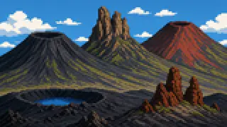
Many of Karuizawa's best-known sights trace back to a single volcano. Follow the waterfalls, the ponds, the forest, and they all lead to the same mountain.
Walk around Karuizawa and you keep running into landmarks built on water and greenery: Shiraito Falls, Kumoba Pond, the Wild Bird Forest. These didn't form separately from one another. They grew on the same foundation: Mount Asama's volcanic activity and the highland climate it creates.
This article traces how Karuizawa's natural landscape came together, through three angles: the terrain the volcano built, the elevation and climate, and the landmarks groundwater created, all with sources.
The Terrain the Volcano Built
Mount Asama is a stratovolcano built from three volcanoes, Kurofu, Hotokeiwa, and Maekake, stacked over time, with the still-active Kamayama crater as its true summit.
Three Volcanoes: Kurofu, Hotokeiwa, Maekake
Mount Asama looks like a single peak, but it's a stratovolcano built from three volcanoes stacked in order of age: Kurofu, Hotokeiwa, and Maekake. Maekake began erupting roughly 10,000 years ago and is the youngest part, the one still venting gas today. The Japan Meteorological Agency describes Kurofu's rock as andesite and Hotokeiwa's as dacitic.
Kamayama and Maekake-yama, Two Summits
The standard hiking route up Mount Asama reaches only Maekake-yama, at 2,524 meters; beyond it lies a permanent no-entry zone. The true summit, still venting smoke today, is Kamayama, at 2,568 meters, whose crater runs about 150m deep, about 500m along its long axis, and about 1.3km around. Climbing the Hyakumeizan-listed "Mount Asama" means, in practice, stopping at Maekake-yama.
The Lava That Made Onioshidashi
During the 1783 Tenmei eruption, the Kanbara pyroclastic flow and debris avalanche swept down the northern slope right after the major explosion on August 5, followed by the Onioshidashi lava flow down that same slope. The jagged rock field left behind when that lava cooled is the landscape known today as Onioshidashi. Records describe the Tenmei eruption as causing severe damage across the foot of Mount Asama, including some 1,061 houses swept away.
Source:Japan Meteorological Agency: Mount Asama, historical volcanic activity
Elevation and Climate
A highland climate at roughly 1,000 meters elevation gives Karuizawa its cool air and a distinct ecosystem.
Usui Pass and the Town's Elevation
The center of Karuizawa Town sits at roughly 1,000 meters elevation, and Usui Pass, which forms the town's southeastern border, reaches about 1,200 meters at its summit. Kumano Kotai Shrine, at that summit, is known for straddling the border between Nagano and Gunma; the elevation itself is what defines Karuizawa's climate.
The Wild Bird Forest as an Outcome
The Karuizawa Wild Bird Forest, part of the Joshin'etsu Kogen National Park, has recorded more than 80 bird species. The highland's cool climate and rich forest cover together created an environment that supports that diversity. The Ministry of the Environment's own model course lists this forest as its first day's observation stop.
Source:Ministry of the Environment: Joshin'etsu Kogen National Park model course
Highland Vegetables at Asama's Foot
From around 1927, growing napa cabbage became a major activity at the foot of Mount Asama. The cool climate that comes with elevation shaped Karuizawa not only as a summer resort but also as a highland-vegetable growing region. Volcanic soil and high elevation left their mark on farming, too.
Source:History of Karuizawa Town
Landmarks Groundwater Created
Shiraito Falls, Kumoba Pond, and the Mikage irrigation channel are all groundwater from Mount Asama surfacing in different forms.
Shiraito Falls
Shiraito Falls isn't fed by a single river running over a cliff. Groundwater that has seeped through the rock emerges along a stretch about 70 meters wide, in hundreds of thread-like streams, and drops down a rock face about 3 meters high. It's an unusual waterfall where groundwater itself, not surface flow, is the main actor.
Kumoba Pond
Kumoba Pond, also nicknamed Swan Lake, is fed by natural springs, with a walking path about one kilometer long around its edge. Being able to walk around a pond formed by groundwater rising to the surface is, in itself, a way to feel the benefit of Karuizawa's terrain firsthand.
Karuizawa Town Botanical Garden
The Karuizawa Town Botanical Garden includes an exhibition hall devoted to the town's plant life. It's a place to see, in a systematic way, the highland vegetation shaped by elevation and climate, and it sets individual landmarks like Shiraito Falls and Kumoba Pond inside a wider natural context.
The Mikage Warm-Water Channel
The Mikage warm-water channel in Oiwake is a 934-meter, 20-meter-wide channel built to move water slowly. Cold groundwater flowing down from the foot of Mount Asama is deliberately kept moving at a crawl so its temperature rises a few degrees before it reaches the rice paddies, turning the mountain's cold groundwater into water suited for growing rice.
Source:Shinano Oiwake Bunka Jiba Aburaya: Oiwake history walks
FAQ
Is Mount Asama still an active volcano?
Yes. The Japan Meteorological Agency keeps Mount Asama under continuous monitoring, and its summit crater, Kamayama, still vents gas today. This article treats the eruption history as a matter of landscape formation; check official sources like the JMA for current warning levels or evacuation information.
I'd also like to know why Karuizawa became a summer resort.
The cool climate itself comes from elevation, but the resort culture that grew on top of it, through missionaries, villas, and local commerce, is covered in a separate article, Who Built Karuizawa's Summer Resort Culture? This article stays focused on physical geography.
Which is Mount Asama's actual summit, Kamayama or Maekake-yama?
The true geographic summit is Kamayama, at 2,568 meters, but it sits inside a permanent no-entry zone, so hikers can only reach Maekake-yama, at 2,524 meters. Climbing the Hyakumeizan-listed "Mount Asama" means, in practice, stopping at Maekake-yama.
Do Shiraito Falls and Kumoba Pond share the same water source?
Both originate as groundwater that has seeped through the Asama volcanic system, but they surface differently: Shiraito Falls drops down a rock face, while Kumoba Pond collects into standing water. It's one case of the same foundation producing two different landmarks.
Sources & references
- Japan Meteorological Agency: Mount Asama
- Japan Meteorological Agency: Mount Asama, historical volcanic activity
- Karuizawa Tourism Association: Kumano Kotai Shrine
- Ministry of the Environment: Joshin'etsu Kogen National Park model course
- History of Karuizawa Town
- Karuizawa Tourism Association: Shiraito Falls
- Karuizawa Tourism Association: Kumoba Pond
- Karuizawa Town Botanical Garden opening guide
- Shinano Oiwake Bunka Jiba Aburaya: Oiwake history walks