A History of Nagano City: Zenkoji, Matsushiro, and the Railway
Ask about Nagano City, and most people picture Zenkoji Temple first. But beneath that temple-town label lie layers of history reaching back to burial mounds, through a divided domain era, to the age of railways.
The Nagano Basin holds ancient life recorded in the Omuro burial mounds, medieval battles and trade routes, and, in the Edo period, several rulers holding pieces of it at once, Matsushiro domain among them. Zenkoji is one center of that story, not its only lead.
Here we trace the basin's shape, the 1897 founding of the city, and the railways that later tied it together, checking sources as we go. The temple buildings of Zenkoji itself and the course of the Battles of Kawanakajima are covered in their own articles.
Ancient and Medieval Layers in the Basin
The Nagano Basin has carried human activity since ancient times, and was a crossing point for both battle and trade.
The Nagano Basin
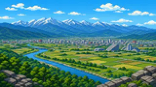
The Nagano Basin, where central Nagano City sits, is the prefecture's second-largest after the Matsumoto Basin. It formed as sediment built up between mountain ranges with different origins on its east and west sides, and volcanic activity, earthquakes, floods, and landslides have reshaped it again and again. The same underground energy behind those disasters also brings the reward of hot springs.
Source:長野市立博物館「1階展示室」
The Omuro Burial Mound Group
East of the basin, in the hills around Omuro, the Omuro burial mound group was built from the early 5th century through the 8th. Roughly 500 mounds cluster within about 2.5 square kilometers, some with stone chambers built gassho-style from angled slabs, others piled as stone mounds rather than earth. About 16 hectares of the group were designated a national historic site in 1997.
Source:長野市「大室古墳群保存整備事業報告書」
Medieval Battles
Through the medieval period, the area now called Nagano City stayed a battleground. The Nagano City Museum lists the battles of Yokotagawara, Urushida, Otsu, and Kawanakajima as medieval conflicts fought here. The course of the Kawanakajima fighting and its commanders are covered in more depth in the article on Kawanakajima and Matsushiro.
Source:長野市立博物館「2階展示室」
Medieval Trade
Even amid the fighting, the basin stayed linked to trade from far beyond it. Medieval-era ruins in the city have yielded Chinese ceramics, coins, and pottery made in Noto and Owari, which the Nagano City Museum displays as evidence that people and goods moved well past the basin's edge. Pilgrimage to Zenkoji was not the only traffic passing through.
Source:長野市立博物館「2階展示室」
Divided Rule, and the Earthquake That Shook the Basin
The area was never unified under one domain, and by the end of the Edo period it had also suffered a major earthquake.
Divided Rule
In the Edo period, what is now Nagano City was a patchwork: Matsushiro, Ueda, Suzaka, and Iiyama domains, shogunate-held land, and hatamoto fiefs all overlapped here. Rather than one domain governing a single castle town, most villages ran largely on their own through appointed headmen and written record-keeping, as the Nagano City Museum explains.
Source:長野市立博物館「2階展示室」
The Zenkoji Earthquake
The Zenkoji earthquake of 1847 struck directly beneath what is now Nagano City at around ten at night, with an estimated magnitude of 7.4, according to the city's disaster records. It hit during a Zenkoji Gokaicho unveiling, when pilgrims had gathered from across the country, which is said to have made the damage worse.
Source:長野市「長野市の過去の主な地震災害」
A Chain of Disaster
The Zenkoji earthquake did more than shake the ground: collapses, fires, and landslides followed one after another. A landslide at Mount Iwakura, on the right bank of the Sai River, dammed the river, and its later collapse flooded dozens of villages, the city's records note. A single disaster reshaped both the land and daily life for a long time after.
Source:長野市「長野市の過去の主な地震災害」
From City Status to a Railway-Linked Modern Era
Nagano City grew from a small area founded in 1897 through a series of mergers and the spread of its rail network.
The Founding of Nagano City
Nagano City was founded on April 1, 1897, centered on Nagano-machi, then part of Kamiminochi District. At founding it covered just 9.05 square kilometers, a fraction of the city's present size.
Source:長野市「沿革」
Mergers That Widened the City
Nagano City did not reach its current shape all at once. After its founding it absorbed neighboring areas in 1923 and 1954, then grew sharply in 1966 through a large merger that folded in Shinonoi City and Kawanakajima-machi, among others. Togakushi, Toyono, Kinasa, and Ooka joined in 2005, with further additions in 2010, bringing the city to about 835 square kilometers.
Source:長野市「沿革」
Railways That Linked Town and Temple
Mergers were not the only force shaping the modern city. JR Nagano Station opened in 1888, and Nagano Dentetsu's own Nagano Station followed in 1928, tying the temple town into a wider rail network. That same transport development would go on to reshape the very pattern of pilgrimage to Zenkoji.
Source:JR東日本「長野駅」長野電鉄「長野駅」
FAQ
Is Nagano City's history the same as Zenkoji's history?
No. Zenkoji is the city's best-known landmark, but the city's history also spans ancient life, medieval battles and trade, divided Edo-era rule, and the mergers and railways that followed. Zenkoji's own temple buildings are covered in the article on its temple town, and the Kawanakajima fighting in the article on Kawanakajima and Matsushiro.
Can Nagano City be called a castle town?
The temple town around Zenkoji itself was never a castle town. But today's Nagano City also includes Matsushiro, seat of the 100,000-koku Sanada domain. Matsushiro became part of Nagano City not through Edo-period rule, but through a 20th-century merger.
Why did Nagano City's borders keep expanding?
At its 1897 founding, Nagano City covered only 9.05 square kilometers. It then grew step by step by absorbing neighboring towns and villages, through the large 1966 merger and further additions in 2005 and 2010, reaching roughly 835 square kilometers today. It never reached its current size in a single move.
Can visitors see the Omuro burial mounds today?
Yes. Of the roughly 2.5 square kilometers over which the mounds are spread, about 16 hectares were designated a national historic site in 1997, and visitors can see the mound shapes on site. Its gassho-style stone chambers and stone-piled mounds are unusual construction methods not seen in most other regions.