What Shaped Suwa? The Basin and Its Mountain Passes
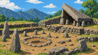
Suwa's history can be measured by one lake and the height of the passes around it.
Lake Suwa sits in a basin 759 meters above sea level, ringed by mountains such as Yatsugatake and Kirigamine. Jomon-era people chose the terraces at the basin's edge to live on, and in later centuries lakeside roads became a crossroads for travel. The terrain barely changed, yet what people did with it kept shifting from era to era.
This article sets aside Suwa Taisha's four shrines and the region's silk-to-precision industrial story, both covered elsewhere, and instead follows how the basin and its passes themselves shaped daily life and exchange from the Jomon period into the early modern era.
The Jomon Period: A First Life Carved into the Terraces
Rather than the low, wet lakeshore, Jomon communities kept choosing the well-drained terraces around the basin's rim.
Togariishi Site
Spread across roughly 1,070 meters on the western foot of Yatsugatake, this site has yielded more than 200 pit-dwelling remains across multiple surveys. It was designated a National Special Historic Site in 1952, and the protected area was expanded in 1993 and 2021 to include the neighboring Yosukeone and Yosukeone South sites. The designated area now exceeds 80,000 square meters, suggesting this was a place people kept choosing over a long span, not just a single settlement moment.
Source:Special Historic Togariishi SiteAdditional Designation of the Special Historic Togariishi Site
Masked Goddess
Excavated at the Nakappara Site in Chino's Kohigashi area, this large dogu stands 34 centimeters tall and weighs about 2.7 kilograms. Made roughly 4,000 years ago in the early Late Jomon period, it was found lying in what is thought to be a burial ground, with its right leg deliberately removed before burial. Excavated in 2000 and designated a National Treasure in 2014, it shows the terraces held traces of mourning as well as daily life.
Jomon Venus
This National Treasure dogu, excavated at the Tanabatake Site in Chino, stands alongside the Masked Goddess. It is 27 centimeters tall, weighs 2.14 kilograms, and is solid rather than hollow, with biotite in its clay giving the surface a faint shimmer. Both National Treasure dogu came from sites within Chino City and are displayed at the Togariishi Jomon Archaeological Museum, evidence that several settlements existed side by side around the same basin rim.
Source:National Treasure Dogu (Jomon Venus)Nationally Designated Cultural Properties
Idojiri Site
South of the basin in Fujimi Town, this Jomon-era site is presented at the adjoining Idojiri Archaeological Museum, which displays pottery, stone tools, and reconstructed scenes of daily life. Read alongside Chino's Togariishi, Nakappara, and Tanabatake sites, it shows that the basin's Jomon settlements were not concentrated at a single point but spread across several places on the surrounding terraces, close enough for people to move between them.
From Kofun to the Early Modern Era: Lakeside Strongholds and Crossroads
The lake and its wetlands were put to use for defense, two highways crossed right at the lakeshore, and the basin's own system of self-government kept being redrawn.
Kofun Cluster (Ichijizaka and Fune Kofun)
These Kofun-period burial mounds remain within Suwa City. Fune Kofun has yielded finds including a wavy sword, now a prefectural treasure, while Ichijizaka Kofun shows an arrangement of pottery interpreted as a rite for the dead. Even after Jomon settlement faded from the record, the basin's edge kept serving as a place to bury people of standing, an older face of the basin than its castle or post town.
Takashima Castle
Hineno Takayoshi chose the site and completed this castle in 1598. Surrounded by lake water and wetlands when new, it looked as if it were floating on Lake Suwa and was known as Suwa's 'floating castle'; tradition holds that an entire fishing settlement was relocated to make way for it. Its keep was torn down in the Meiji era but rebuilt in May 1970, and the castle later joined the Continued Top 100 Japanese Castles. It is a clear case of a lake's wetlands doing double duty as a defensive work.
Source:Suwa Takashima Castle
Shimosuwa-juku
This post town thrived where the Nakasendo and Koshu Kaido highways converged. Buildings such as the Honjin Iwanami Residence and the Fushimiya House still stand, and Shimosuwa Town has preserved them under a plan for maintaining the town's historic townscape. That two highways linking Edo with Shinano and Kai met at this single point in the basin shows Suwa was never an isolated mountain pocket; it was a junction people and goods crossed the passes to reach.
Source:Shimosuwa Town Plan for Maintaining Historic TownscapeList of Shimosuwa Town Cultural Properties
Former Okaya City Hall
Okaya was once a village called Hirano, but in 1936 it became a city directly, without first becoming a town, and its city hall was built that same year. Where the post town and castle speak to the basin's early modern shape, this building marks the moment local government itself was redrawn for the modern era, a new administrative form inheriting the exchange the basin and its passes had built up over centuries.
Source:Former Okaya City Hall
FAQ
Where's the best place to start with Suwa basin's history?
Pair the Jomon terrace sites with lakeside Takashima Castle and Shimosuwa-juku. The same basin held two very different uses of land, highland living and lakeshore transit, and seeing both side by side makes the contrast clear.
Why are so many Jomon sites concentrated in Chino City?
Chino has broad terraces on Yatsugatake's western foot with good sun and drainage. That said, Fujimi Town's Idojiri Site shows settlement wasn't limited to Chino alone.
Why was Takashima Castle called a 'floating castle'?
When it was completed, lake water and wetlands surrounded it so closely that it appeared to float on Lake Suwa, a much wetter setting than today's built-up shoreline would suggest.
What still shows that Shimosuwa-juku was once a major crossroads?
Buildings like the Honjin Iwanami Residence and Fushimiya House remain in the town today, preserved under Shimosuwa Town's own plan for maintaining its historic townscape.
Sources & references
- Special Historic Togariishi Site
- Additional Designation of the Special Historic Togariishi Site
- National Treasure Dogu (Masked Goddess)
- National Treasure Dogu (Jomon Venus)
- Nationally Designated Cultural Properties
- Idojiri Site and Idojiri Archaeological Museum
- Guide to Designated Cultural Properties and Sites
- Suwa Takashima Castle
- Shimosuwa Town Plan for Maintaining Historic Townscape
- List of Shimosuwa Town Cultural Properties
- Former Okaya City Hall