Nikko: Walking through local names
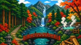
Senjogahara's ominous name comes from a legend about warring deities; Ryuzu Falls is named for a shape that looks like a dragon's horns. Tracing the origin of each name changes how the landscape itself reads.
Okunikko's lakes, falls, marshes, and highlands each carry a name with its own backstory. Rather than treating them as labels to memorize, it helps to ask why each name was given in the first place.
The pairs below sit next to each other geographically, or connect through the same flow of water. Keeping track of upstream versus downstream, or nearer versus farther, makes similar-sounding place names easier to separate.
Walking through local names: Okunikko and Senjogahara Marshland
Okunikko is the broad area name that includes Lake Chuzenji and Senjogahara, while Senjogahara is one marsh inside it.
Okunikko
Okunikko is the name for the highland area, roughly 1,200 to 1,700 meters in elevation, that includes Lake Chuzenji, Senjogahara, and Lake Yunoko. It runs several degrees cooler than central Nikko, drawing summer visitors escaping the heat and winter visitors for snow and ice. Both Nikko Yumoto Onsen and Chuzenji Onsen fall within this same area.
Senjogahara Marshland
Senjogahara is a high moor between Lake Yunoko and Lake Chuzenji, named for a legend that the deities of Mount Nantai and Mount Akagi fought over control of Lake Chuzenji here. It was registered as a Ramsar wetland in 2005 and is popular for boardwalk hiking. It names one marsh within the much broader Okunikko area.
Walking through local names: Lake Yunoko and Ryuzu Falls
Lake Yunoko is the source lake, and Ryuzu Falls is where the water it releases eventually drops.
Lake Yunoko
Lake Yunoko sits beside Nikko Yumoto Onsen and is thought to have formed when a lava flow from Mount Konsei dammed the valley. In winter it freezes over, turning it into a spot for ice fishing and skating. Water leaving this lake goes on to become the falls described next.
Ryuzu Falls
Ryuzu Falls is where the Yukawa River, having left Lake Yunoko, strikes a rock and splits into two channels just before reaching Lake Chuzenji. It runs about 210 meters in total, and its divided streams are said to resemble a dragon's pair of horns, which gives the falls its name. Remembering that it draws from Lake Yunoko and empties toward Lake Chuzenji fixes its place on the map.
Walking through local names: Nikko Cedar Avenue and Akechidaira
Nikko Cedar Avenue is the tree-lined road itself, while Akechidaira is where the view opens up partway along it.
Nikko Cedar Avenue
Nikko Cedar Avenue names the cedar-lined stretches along three approach roads, including the Nikko Kaido, running about 35 kilometers. An estimated 200,000 trees were planted at its peak, and around 12,500 cedars still stand today. It holds the rare distinction of being both a Special Historic Site and a Special Natural Monument at once.
Akechidaira
Akechidaira sits at the point where the first and second Irohazaka roads meet, and a ropeway there carries visitors up to a deck overlooking Kegon Falls, Lake Chuzenji, and Mount Nantai. Coming after a stretch shaded by cedars, this spot where the view suddenly opens up feels like a turning point on the road toward Okunikko.
Walking through local names: Kirifuri Highlands and Daiya River
Kirifuri Highlands lies northeast of central Nikko, while the Daiya River runs through the town center near the shrines.
Kirifuri Highlands
Kirifuri Highlands is a highland area northeast of central Nikko, named for the nearby Kirifuri Falls. It once held a ski resort and campgrounds and has served as an outdoor base across the seasons. It sits in the opposite direction from Okunikko, giving Nikko a second highland area.
Daiya River
The Daiya River flows beneath the Shinkyo Bridge, carrying water from Lake Chuzenji down through central Nikko, and a gorge section called Kanmangafuchi Abyss is known for its rows of Bake Jizo statues. Though it belongs to a different watershed and direction than Kirifuri Highlands, both places can be located relative to the same central town.
FAQ
What is a useful route for this theme in Nikko?
Starting from Okunikko and moving through Senjogahara to Lake Yunoko traces a path from the broad area name down to specific marshes and lakes.
Should these names be memorized in isolation?
Attaching the origin of a place name is what makes it easier to separate from similar-sounding names in the same category, such as other lakes or falls.
Where should visitors verify the details?
Each entry lists a primary source from a municipal or tourism body at the end. Check the official page for snow or road closure information before you visit.