Mount Shosha and Himeji's Landscape: Temple, Mountains, and Sea
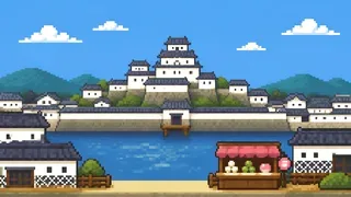
A map of Himeji that stops at the castle misses the relationship between mountain, sea, and city. Mount Shosha and Engyoji Temple, Mount Hiromine in the castle view, the Seto Inland Sea, and Ichikawa River extend the story into a complete local landscape.
Mount Shosha appears in the tourism route to Engyoji Temple, while the official guide identifies Mount Hiromine as a mountain visible from the castle keep. Keeping these two mountain roles separate is the first step toward reading Himeji's views accurately.
This article moves across three scales: the route up Mount Shosha, the mountain seen from the keep, and the broad geography of the Seto Inland Sea and Ichikawa River.
The road to Engyoji on Mount Shosha
Engyoji Temple is on Mount Shosha, which also has the ropeway station for reaching the temple.
Mount Shosha
Mount Shosha is the mountain with the ropeway station for Engyoji Temple. Remembering the route as “up Mount Shosha to visit Engyoji” connects the mountain name to a movement through the landscape instead of leaving it as an isolated place-name answer.
Source:Shoshazan Engyo-ji Temple | Visit Himeji Official Travel Guide
Engyoji Temple
Engyoji Temple is identified as the temple on Mount Shosha in Himeji City. It gives the western mountain route a destination distinct from the castle, allowing a visit to connect the urban castle town with a religious space in the hills.
A mountain seen from the keep
The official guide identifies Mount Hiromine as visible from Himeji Castle's keep.
Mount Hiromine
Mount Hiromine is the mountain identified in the official guide as visible from Himeji Castle's keep. It is a different kind of clue from Mount Shosha: the question is about what the castle looks toward, not which mountain carries the route to Engyoji.
Source:Himeji Castle official guide
Reading the hills from Himeji Castle
A castle keep is also a place from which the surrounding land can be read. Mount Hiromine gives the official view a named landmark, helping visitors imagine Himeji Castle not as a closed monument but as a high point looking across the terrain around the city.
Source:Himeji Castle official guide
The sea to the south and the river through the city
Himeji borders the Seto Inland Sea, while Ichikawa River runs north to south through the central city area.
Himeji on the Seto Inland Sea
The sea bordering Himeji City is the Seto Inland Sea. Moving from the castle's white walls to the open water changes the scale of the view: Himeji is not only an inland-looking castle town, but also a city facing a major inland sea.
Ichikawa River
Ichikawa River is the representative river flowing north to south through central Himeji. Adding its line to the Seto Inland Sea gives the map a city-scale feature between the hills and the coast, turning a list of names into a connected landscape.
FAQ
Which mountain has Engyoji Temple?
Mount Shosha. The ropeway station for reaching Engyoji Temple is also on Mount Shosha, so the mountain and temple belong together as an access route.
Which mountain is visible from Himeji Castle's keep?
The official guide identifies Mount Hiromine. Mount Shosha is the mountain associated with the route to Engyoji, while Mount Hiromine is the named mountain in the keep's view.
Which sea borders Himeji City?
The Seto Inland Sea. It places Himeji's castle-town landscape in a broader coastal geography rather than treating the city as a purely inland settlement.
Which representative river flows through central Himeji?
Ichikawa River flows north to south through the central city area. Together with the Seto Inland Sea, it helps place the urban landscape on the map.